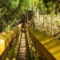
![Boat parking at The Crow’s Nest in Venice [Photo: Lauren Jackson]](/sites/default/files/styles/popular_stories_teaser/public/2023-import/The-Crow%2527s-Nest-cropped__OPT.jpg.webp?itok=F_GZSs8A)


Get Into The Flow: Sarasota County Waterways
Check out the Blueways Paddling Guide by Sarasota County Parks, Recreation and Natural Resources.
Check out the Blueways Paddling Guide by Sarasota County Parks, Recreation and Natural Resources.
Sarasota County on Florida's Gulf Coast is a unique landscape of waterways, wildlife and natural habitats weaving between and through bustling cities and towns. Even neighborhood creeks and streams are part of a network of trails that offer abundant beauty and provide a critical protective habitat wildlife.
The Sarasota County Department of Parks, Recreation and Natural Resources lists 11 area waterways to explore in ther new "Blueways Paddling Guide," including the Sarasota Bay Trail, the Lido and South Lido trails, the Phillippi Creek Trail, the Neville Marine Preserve Trail, the South Creek Trail, the Dona Bay/Roberts Bay trails, the Caspersen Trail and the Lemon Bay Trail. Get a taste of the guide below, check out a digital copy, or pick up a guide today at the downtown Visitor Center at 1945 Fruitville Road, Sarasota FL, 34236.
Sarasota Bay Trail
The Sarasota Bay Trail is starts in the northwestern portion of Sarasota County and stretches to downtown Sarasota. This is an open water trail, so paddlers should be prepared. A breeze or strong tide can make paddling difficult and paddlers should have experience dealing with waves.
Trips
Whitaker Bayou
Paddle north from Centennial Park Boat Ramp into Whitaker Bayou (about 1/2 mile.) You'll pass the Ringling College of Art and Design and eventually the trail winds through drainage canals.
Island Park to Eloise Werlin Park
Paddle a two-mile loop between Parks. Restuarans and public restrooms are available.
Ted Sperling Nature Park to Bird Key Park or Ken Thompson Park
This trail is four to six miles, depending on the route you take.
Launch
Launch from Overlook Park (101 Gulf of Mexico Drive), Bayfront Park (across from downtown Sarasota), Centennial Park (1059 N. Tamiami Trail at 10th Street) or Ken Thompson Park (1700 Ken Thompson Parkway)
Check out the route map here.
Lido Trail
Lido Trail runs from the downtown area of the Sarasota bayfront and includes Lido Key and the southern portion of Longboat Key. Be aware of boat traffic and strong currents when crossing Big Sarasota Pass.
Trips
Ted Sperling Nature Park
One of the most popular paddling trails in the area, this 1-mile paddle through mangrove tunnels that winds through Big Grassy Lagoon and Brushy Bayou.
Quick Point Nature Preserve to Ken Thompson Park
A two-mile loop that also offers waterfront restaurants, picnic areas and fishin piers.
Launch
Launch at Bird Key Park (200 John Ringling Causeway), Ted Sperling Nature Park (190 Taft Drive), Ted Sperling Park at South Lido Beach (2201 Ben Franklin Drive) or Siesta Key Beach Access #1 (3940 N. Shell Road)
South Lido Trail
Located at Ted Sperling Nature Park at the southernmost tip of Lido Key, this tour is considered one of the most diverse trails in Southwest Floirda. Traverse through Sarasota Bay before entering LIttle Grassy Lagoon through winding mangrove tunnels and enter into the Brushy Bayou.
Habitat
Mangroves and wetlands areas are an important natural resource to all of Florida. They are essential to the estuarine ecosystem and provide a number of benefits to bay life. Be sure to check out the full guide to learn more about the different types of habitats!
Phillippi Creek Trail
Phillippi Creek Trail extends through the heart of the city of Sarasota, from Roberts Bay to north of Bahia Vista Street. This is a great trail for beginning paddles. While there is light boat traffic, from the mouth of the creet to U.S. 41 is a slow speed zone and after that it is a idle speed zone/no wake.
Trips
About three miles upstream for a launch at Phillippi Estate Park is Pinecraft Park. This trail takes you through residential neighborhoods. Alternatively, about four-miles from Phillippi Estate Park downstream is the mouth of the creek that leads to Roberts Bay.
Launch
Launch at Pinecraft Park (1420 Gilbert Ave), Phillippi Estate Park (5500 S. Tamiami Trail) or Christopher Wheeler Park (1300 Old Stickney Point Road)
Lemon Bay Trail
Lemon Bay Trail begins at Manasota Beach and goes south into Charlotte County offering more than 20 mile of paddling opportunities
Trips
From Indian Mound Park to Tom Adams Bridge, this loop offers a great fishing opportunity as there is a bait shop at the pier on the east side of Tom Adams Bridge. A five-mile loop can be made paddling Indian Mound Park to Stump Pass Stat Park. This is a wonderful paddle to view mangrove islands and the birds that inhabitat them.
Launch
Launch from Lemon Bay Park and Environmental Center (570 Bay Park Blvd., Englewood), Indian Mound Park (210 Winson Ave.) or Cedar Point Environmental Park (2300 Placida Road).
Myakka River/Myakkahatchee Creek Trails
The river and creek located between Venice and North Port that flows into Charlotte Harbor, "Myakkahatchee" is believed to be derived from the Seminole language meaning "big water" or "big river." When paddling through this creek, the route may be constricted with varying water levels, which will require portages. Traveling south of Price Boulevard is the most suitable route for novice paddlers.
Trip
From butler park to Myakka Stat Forest is a six-mile loop that reaches Myakka State Forest. About one mile into the journey you will have to portage around a dam.
Launch Points
Launch from Butler Park (6205 West Price Blvd.) or Myakka State Forest (2555 S. River Road)
Explore even more!
Use the Blueways Paddling Guide for many more routes to explore. Check the guide before you go for important information including a resource directory.